
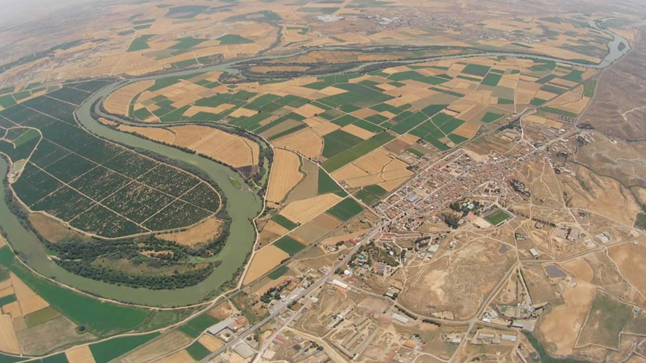
On 20 June 2026 the eleventh launch of the Servet series took place at the sports hall in Quinto, Zaragoza.
The balloon reached a maximum altitude of 34,269 metres and landed near Villamayor de Gállego after a little over two hours of flight.
The launch took place from the sports hall in Quinto at 12:34. Schools, volunteers, technicians from the collaborating organisations and local people took part in the preparation and set-up, and followed the inflation and release of the balloon closely.
The capsule carried several instrumentation and tracking systems on board: multiple APRS transmitters, LoRa devices connected to the TTN (The Things Network) network, cameras, a SPOT GEN3 tracker and pressure and altitude sensors. Real-time tracking was carried out through different platforms, including predict.sondehub.org, and the signal was received by receivers spread across the whole Iberian Peninsula, even reaching TTN gateways in France and North Africa, which highlights the reach of the LoRa coverage network at high altitudes.

The balloon climbed at an average speed of 5.47 m/s, reached its maximum altitude of 34,269 metres at 14:17 and began its parachute-assisted descent. The maximum fall speed recorded was 84.8 m/s (equivalent to 305 km/h), usual in the depressurisation and bursting phase of the balloon. The capsule landed near Villamayor de Gállego at 14:46, in a farming area, and was recovered at coordinates 41.698350, -0.761410 at an altitude of 334 metres.

The images obtained during the flight show the curvature of the Earth from the stratosphere, with the Ebro Valley and the surrounding mountain ranges visible on the horizon. The altitude, pressure and telemetry data were recorded and are available for analysis.


The Servet project is part of the citizen science activity in the stratosphere carried out by the I3A (University Institute for Research in Engineering of Aragon) of the University of Zaragoza, with the collaboration of the Ibercivis Foundation in communication and outreach, Teconecta on the technology side, and Quinto Town Council as host and local logistical support.